Went down to the Moab area to check out Arches NP over the memorial day weekend and do all the usual tourist stuff. We set up camp on some BLM land just North of town and were serenaded all night by 4 wheelers and diesel pickup trucks. Apparently some people feel that enjoyable recreation is impossible below 100 decibels. We got up in the morning, cooked breakfast, peppered it with diesel exhaust ash, and headed down to the park.

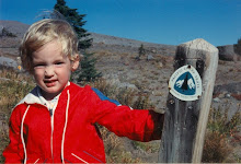
Standing around camp

Camping under a full moon

Posed photo in front of Delicate Arch,
of license plate fame

It blows my mind that such a sign exists.
After Delicate Arch we hiked to Double O Arch, creatively named for the two O-shaped holes in the rock.It was a fun hike with lots of rock hopping and expansive views in all direction.

Me walking across the top of Double O Arch.
On Sunday, we went to the Tusher tunnel. It's a natural tunnel in a sandstone bluff that formed after water seeped through a crack. The tunnel goes all the way from one cliff face to the other. It's neat.

In the Tusher Tunnel
*This is not true.
1 comment:
I'm really jealous - looks beautiful.
Post a Comment