Monday, June 21, 2010

Monte Cristo and Superior

The snow is all but gone from slopes on a southerly aspect, so this weekend seemed like a good time to climb Superior and Monte Cristo in summer conditions. Summer is trying to get here, but once gaining the ridge, a lot of the route looked like the highly precise diagram 1. This is why the trip took so long.

 Diagram 1: Typical ridge conditions
Also it was windy.
That makes 4 11ers down!

Sunday, June 13, 2010

It's like RAAAIIIIIINNNN on your skiing day

I recently summited my second 11,000 ft peak and managed a clumsy ski descent. The forecast showed a 70% chance of rain, but that seemed like a pathetic and un-manly reason to stay in so we went for it anyway. We drove up the canyon in heavy rain which miraculously cleared about the time we got to the parking lot. By this time we were high enough to be in the clouds, and were treated to this stunning view while skinning up:


Now, climbing mountains is a serious endeavor, particularly when there is snow on the ground, and to some extent requires specialized gear as well as a certain amount of preparedness. Imagine my confusion then when near the summit we were passed by a blond-haired, blue-eyed German man carrying no gear and dressed in black slacks, black suspenders, a dress shirt, a black beret, and a ¾ length black trench coat. Seriously. After a brief stay on the summit, he wandered off into the fog. I tried to get a picture of him, but he didn't show up on camera, confirming my earlier suspicion that he was a ghost. Or it was foggy. Whatever.

Anyway, upon arrival to the summit I pulled out my camera and snapped a shot of the grand vista laid out before us:


And of course we needed incontrovertible proof that we had actually been on the summit, so:

After a quick break on the summit, it was time for a clumsy ski down the same route after determining the chute we wanted to shoot didn't have enough snow. The snow was heavy, soft and hard to ski up top. The poor bond between new and old snow only exacerbated the situation. Of course, it is the middle of June so I suppose I shouldn't be complaining. Lower down the snow got a lot better and was more fun until it started pouring rain mixed with little pieces of graupel. We hurried to the truck and made a hasty retreat to the Great Salt Lake Valley where the sun once again graced me with its presence.

Friday, June 4, 2010

Red Rocks: Moab Aeterno

Went down to the Moab area to check out Arches NP over the memorial day weekend and do all the usual tourist stuff. We set up camp on some BLM land just North of town and were serenaded all night by 4 wheelers and diesel pickup trucks. Apparently some people feel that enjoyable recreation is impossible below 100 decibels. We got up in the morning, cooked breakfast, peppered it with diesel exhaust ash, and headed down to the park.
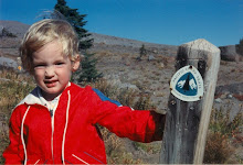
Standing around camp


Camping under a full moon
We started the short hike to Delicate Arch, famous for being on the Utah license plate. Actually, as far as I can tell, it's famous because it's very photogenic. From the proper angle, the arch stands out from the rest of the landscape and nicely frames the La Sal mountains in the background. (See this Google Image Search. Most pictures of the arch are identical.)There have been millions of pictures taken of this arch. Seriously. Geologists are worried that photon bombardment from all the cameras is accelerating erosion of the arch.* (Fun fact: The La Sal mountains were named by a Spanish explorer who saw large patches of white stuff on the mountains and assumed it was salt, La Sal being Spanish for "The Salt." Turns out it was snow. Mexico then ceded the region to the USA in the 1840's  out of embarrassment and to avoid confusing its citizens.)
Posed photo in front of Delicate Arch, 
of license plate fame

It blows my mind that such a sign exists.

After Delicate Arch we hiked to Double O Arch, creatively named for the two O-shaped holes in the rock.It was a fun hike with lots of rock hopping and expansive views in all direction.
Me walking across the top of Double O Arch.

On Sunday, we went to the Tusher tunnel. It's a natural tunnel in a sandstone bluff that formed after water seeped through a crack. The tunnel goes all the way from one cliff face to the other. It's neat.
In the Tusher Tunnel

 *This is not true.

Wednesday, May 12, 2010

Powder turns? On May 12th?

It's more likely than you think.


Sunday, May 9, 2010

Sugarloaf 2: The Sugarloafening

Dedicated blog readers will recall that last year I tried unsuccessfully to summit Sugarloaf Peak. This year I decided to rectify my failure in true Utah style- on skis. I got up at 5 (in the morning) and headed up Little Cottonwood Canyon for a solo ski adventure. I skinned uphill for a couple uneventful hours until I reached the ridge below the summit. It was very scenic and I saw things like the people at Snowbird who got to ride lifts up to the altitude I'd just spent nearly two hours attaining. I shook my fist at them in impotent rage.


Figure 1: Doing the sacred ski dance below the
summit to appease the mountain gods.


With the pleasant hum of ski lifts in the distance I started skinning up the ridge to Sugarloaf, then stopped to strap my skis to my pack and booted up the rest of the way on intermittent snow and talus.

Figure B: Sastrugi!

A short while later I Captain Morgan'd the summit.
Illustration 3: Captain Morganing the summit cairn


Image 4: View from the summit with
mighty Mt. Timpanogos in the distance


And then my camera's battery died. But all I really did after that was ski down the way I came up. I skied from the summit all the way back to the Taco save for about 10 feet where the snow didn't quite cover some talus. The snow was pretty hard going down Sugarloaf, but below the saddle the sun had cooked it to perfect spring conditions.

Monday, April 19, 2010

Dusting off the hiking boots

I was hoping for a nice snow-free hike up Mt Olympus yesterday, but alas it was not to be. About 2/3 of the way up the 4,200 ft ascent, snow appeared. It was perfect on the way up: just soft enough to kick steps and put an ax in, but still supportive.

Mandatory summit shot:


Summit panorama:
As the sun cooked the snow, it softened. I was sinking balls deep on the way down. Never before has something inanimate prompted me to string together so many four letter words so creatively. Back on dry land again, I motored past the small children, shirtless frat bros and kids sitting on a rock playing guitar (it's a popular trail, although the crowds went way down at snow line) and arrived back at the Taco 6.5 hours after starting.

Saturday, April 10, 2010

Avalanche Rescue Dogs

The other day I had the opportunity to be involved in a demonstration with an avalanche rescue dog. Lots of ski resorts keep dogs around because in the event of an avalanche they can sniff you out from underneath quite a bit of snow. The bad news is that it takes some time for your scent to waft up through the snow, so a dog rescue is still a last resort. The best plan is not getting caught in the first place. In any case, here's how dog rescues work.

Step 1: Get in a hole in the snow
Step 2: Get inescapably sealed in
Step 3: Let Jake the avalanche dog sniff around and dig you out. (Kind of a bad picture.)
Step 4: Play tug o' war with Jake the avalanche dog. That's his reward; the promise of getting to play keeps him motivated. Plus he pulls really hard, which can help you get out of the hole in the ground.
Posted by Picasa

Wednesday, March 24, 2010

Did you know


that this stunning view is only 14.67 miles from my house? I can go places like this on weekday mornings before work. Life is good.
Posted by Picasa

Wednesday, March 10, 2010

Hey I still have a blog! Neat!

I've been skiing the backcountry lately. It combines the painful exertion of cross country skiing with the epic wipeouts of downhill skiing. It's awesome.


Almost on top...


A quick descent after hours of climbing


That's a faceplant.